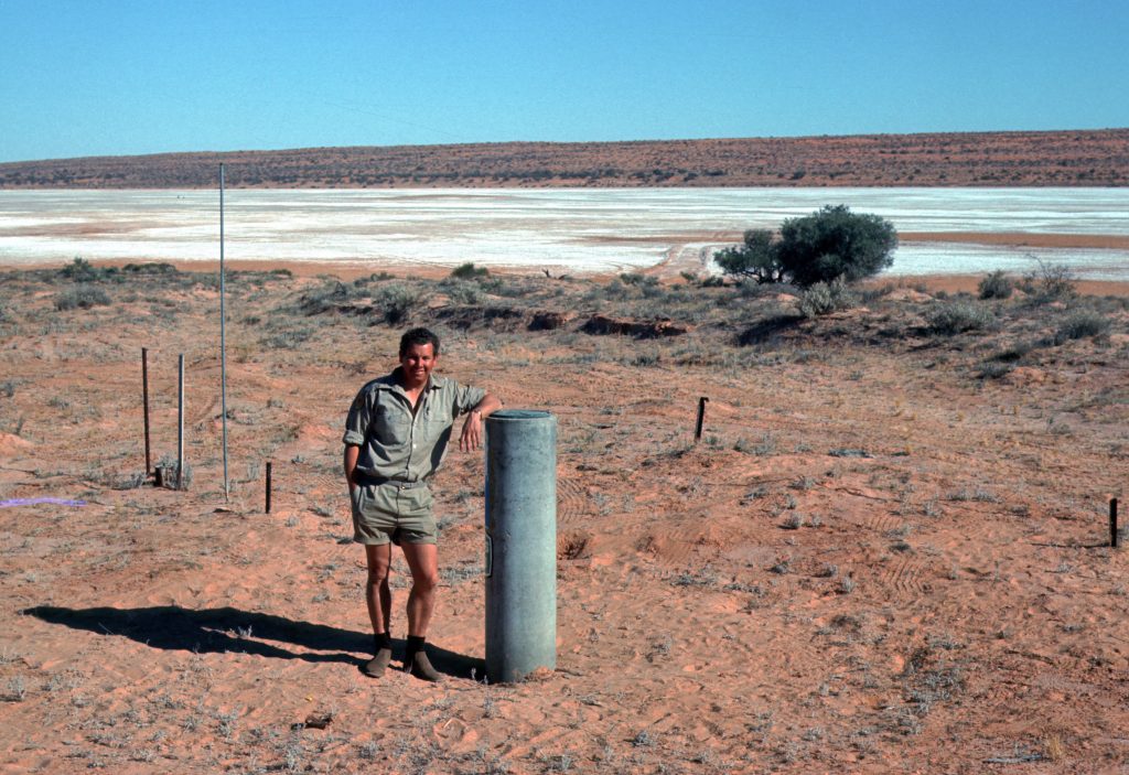
In 1972, on one of the many trips across the Simpson Desert, George Cornwall actually had his photo taken at Poeppel Corner.
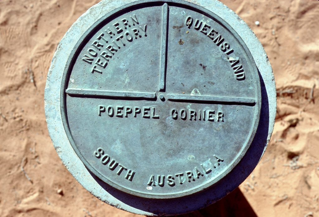
Located at latitude 26° S and longitude 138° E is a corner of state boundaries in Australia, where the state of Queensland meets South Australia and the Northern Territory. As with the other three corners it is a destination for four-wheel-drive tourists. Poeppel Corner is about 174 km west of Birdsville, in the middle of the Simpson Desert.
Augustus Poeppel, after whom the point is named, conducted a survey in the mid-1880s to find the exact location of the central Australian colonial borders. His team used camels to drag a coolibah post to mark the intersection. Originally the point was located in a salt lake, but it was found that the measuring chain used was a few centimetres too long. Another survey was conducted by Lawrence Wells, who relocated the post to its current position
Photos from George Cornwall’s Collection
For more information about Outback South Australia